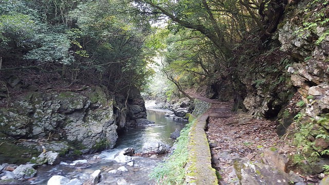
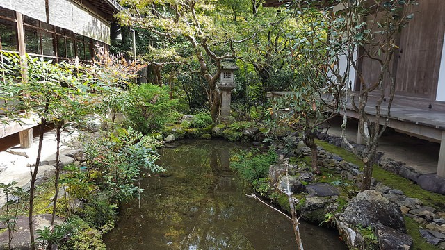
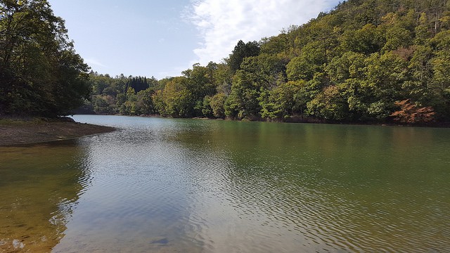
Back in October 2016, I was at the last part of my Japanese trip, and I did part of the Kyoto Trail. I normally go to places with local immersion in mind, so my trip to Kyoto wasn’t going to be less. I sent a couple of CouchSurfing requests in order to get hosted and/or visit the city with the hand of a local. And the good luck was with me this time.
I had the great pleasure to meet Hiroshi (Hiro for friends), a local. Well, he isn’t really from Kyoto, but had been living there for 4 years at that time. So he knows very well the city and it’s surroundings. He and I became a good match even while talking via CouchSurfing and other messaging apps. He liked walking here and there. Getting into local places, no matter if they were very popular or not. Moving through the cities with a bycicle or on foot. And of course, hiking.
Contents
Sunset at the Eastern Kyoto Trail

The first afternoon we spent together, he brought me to a viewpoint at eastern part of the city. It is actually very near to the eastern track of the Kyoto Trail. And we enjoyed the sunset views with a small bottle of sake 🙂
To get there, I’d reccomend you use a bike. It’s really common to rent one, for locals and for tourists. They are priced nicely (I got mine for about 500 yen or 5€/day). Kyoto is not so big, but big enough to make it less walkable as desirable. I walked most of the time, but a couple of days I did use a bike. The route to get there from a centric spot is this one:
The different paths of The Kyoto Trail
The Kyoto Trail, isn’t actually a path, but many of them. After my research asking locals and in the internet, it seems that there are 2 major routes. One of them, is a circular path located in the forests of Keihoku area, Northwest from Kyoto (40km length). And then, there’s an 80km trail that surrounds Kyoto almost completely.
The trail that circles Kyoto, is often split in 3 subtrails: the Western subtrail, the Northern subtrail and the Eastern subtrail. I only made time for one trail, and it happened to be the Northern one. Mainly because my friend Hiro said it was the best part.
You can see one of the maps here and another one here too. They more or less match with eachother.
Western Kyoto Trail
The main points along the Western Kyoto Trail are the following ones:
- Kamikatsura
- Kokedera temple
- Bamboo forest in Arashiyama neighbourhood
- Kiyotaki river (link with the Northern Kyoto Trail)

If you intend to go through the bamboo forest itself, and make a proper exploration, possibly you would like to do this trail in the afternoon. There would be less people by the time you reach the bamboo forest, so it will be nicer to see it. Otherwise, you might get annoyed with the mass of tourists.
Northern Kyoto Trail
This was the section I walked with my Japanese friend while I was in Kyoto. We didn’t make it until the end, due to time constraints. However, I’m sure is totally worthy and it could be even a good idea to sleep at some point near the Eastern Kyoto Trail connection (before Mount Hiei/Hieizan).
The starting point is close to the Arashiyama area. You can get there easily by bus or train. To return, if you shorten your trip and finish in Ninose/Kurama train stations, it would be easier to return to the city than if you continue further. Anyway, if you want to make it to Mount Hiei, it is possible as well to return using a train. Just check the timetable (at the end of the article I provide more info about public transport).
The itinerary that you are supposed to follow is this one:
- Kiyotaki river (link with the Western Kyoto Trail)
- Kōzan-ji temple
- Sawanoike pond
- Ninose train station
- Kurama train station
- Mount Hiei (or Hiei-zan) (link with Eastern Kyoto Trail)
Again, if you intend to see the bamboo forest, in Arashiyama area, it would be wise to reach there by 8 or 8:30AM. There will be barely anybody around.
A few pictures highlighting the main stops of this trail:


Eastern Kyoto Trail
You can find a bit more of information related to this path over here:
http://www.kyoto-trail.net/course_kita_e1_e.html
I haven’t done this one myself, and I know very little about it, but I have taken the time to gather the itinerary and to prepare the path in the map below.
The itinerary of the Eastern trail is this one:
- Mount Hiei (link to Northern Kyoto Trail)
- Uryuyama mount
- Daimoniyama mount
- Shogunzuka
- Kiyomizu temple (Kiyomizu-dera)
- Sennyiuji temple
- Fushimi Inari-Taisha (temple)
Practical tips for hiking in Japan
- There are black bears all around Japan. Although it is rare, some bears have attacked people. A few hints on how to treat with them are this ones (seen at the beginning of many trails):
- Do not bring food with you, they can smell it
- Make noise while walking, either by clapping your hands or with a bear bell (you can hang it in your bag to make noise)
- Talk with your hiking mates often (to make noise)
- In case of an unlikely encounter, don’t run nor make any sudden moves. And do the following:
- stop
- then start walking slowly backwards while keeping eye contact
- when you have lost sight with the bear, turn around and don’t use the same track
- notify other people about the bear
- Beware of weather changes, they do happen quickly in Japan. Bring a light rainjacket in your bag.
- Use the mobile app HyperDIA to check buses, trains and metro lines (by far the best, and it works in the whole country):
- Website: http://www.hyperdia.com/en/
- Android devices (Google Play): https://play.google.com/store/apps/details?id=com.hyperdia.android.activity&hl=en
- iOS devices (AppStore): https://itunes.apple.com/jp/app/id379001449?mt=8
Apúntate a nuestra newsletter semanal
Te enviaremos un correo cada semana con el nuevo artículo junto a las novedades de nuestra app móvil de senderismo.

