Hiking Sierras de Cazorla – “Bosques del Sur” track GR-247

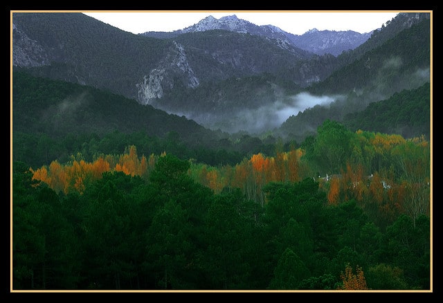
Hiking Sierras de Cazorla can be perfect for a weekend, or for an exigent multiday trek. In the inner province of Jaén, in Andalusia, we found one of the most well renowned natural parks of Spain. The Sierras de Cazorla, Segura y Las Villas Natural Park. And in the heart of this natural paradise, there is the long GR-247, or “Bosques del Sur” track, which is divided in 21 main stages.

Hiking Sierras de Cazorla (Maximo Lopez CC BY-ND 2.0)

Fauna and flora spotted while Hiking Sierras de Cazorla

Here you can enjoy of the very beginning of the Guadalquivir river. A varied range of wild animals like:

  • Deers
  • Mountain goats
  • Wild boars
  • European mouflon
  • Fallow deer
  • Griffon vulture

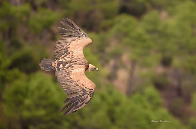
    Hiking Sierras de Cazorla – Volture ( Ramón Portellano CC BY 2.0)
  • Golden eagle
  • Bearded vulture or ossifrage
  • Spanish algyroides or Valverde’s lizard
  • Foxes

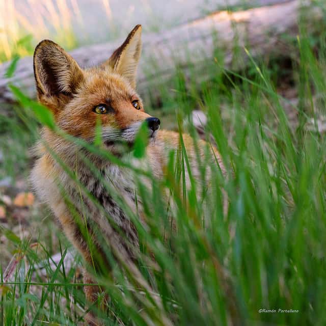
    Hiking Sierras de Cazorla – Fox ( Ramón Portellano  CC BY 2.0)

Continue reading Hiking Sierras de Cazorla – “Bosques del Sur” track GR-247

Puig Campana to Ponoig trek

Last April, I went with a very good friend of mine to do a trek near my hometown. I grew up in the province of Alicante, in Southeast Spain. In a very tiny town named Xirles, 15km off the coast. My friend and I wanted to sleep at the mountain, in order to do a longer trek, and enjoy the evening. So we hiked two of the most relevant mountains in the area. Puig Campana and Mount Ponoig (Sleepy Lion in English, or “León Dormido” in Spanish).

Puig Campana is a mountain with an elevation of 1,406 m (4,613 ft). And Mount Ponoig is 1,181 m (3,874 ft). These mountains are very close to each other. From top to top, the shortest walkable distance is only 4,11km.

Legends of Puig Campana

Among the locals, there are a few stories that talk about the mountain of Puig Campana. I’ve even checked in the Wikipedia, in order to see if some match the one I remember since I was a child. But none fit, although they are very close between each other in the essence of the myth.

Puig Campana legend and it's missing chunk
Puig Campana legend and it’s missing chunk

Continue reading Puig Campana to Ponoig trek

Camí de Ronda, the longest trekking of the Costa Brava

During the past easter of 2017, I did with a friend of mine El Camí de Ronda (Catalan) or El Camino de Ronda (Spanish). It was a 5 days trek through the Costa Brava (Girona), to one of the most famous trekking routes of the Mediterranean.

This coastal path got formed during the 19th century, due to small footprints through the cliffs. But during the 20th century, it was used by the Guardia Civil (Spanish military forces) to prevent smuggling. Nowadays, this beautiful trekking route, has only leisure purposes. You can either walk it by parts or in a row.

You can start the trekking route at the North of the Girona province, in Portbou, and go until the South of the Tarragona Province, in Ulldecona. Apparently it actually goes all the way down to Malaga, in Andalusia. The difference between regions is big, and the worst one is the part of the Valencian Community, which is not signposted at all. The length of the whole route of El Cami de Ronda through Catalonia is 583 kilometers, and you could check the itinerary of the Catalan path here.

Between Llançà and Port de la Selva (Cami de Ronda)
Between Llançà and Port de la Selva (Cami de Ronda) / Picture by Teresa Grau Ros https://www.flickr.com/photos/teresa_grau_ros/15401298963

Continue reading Camí de Ronda, the longest trekking of the Costa Brava

Esta web utiliza cookies propias y de terceros para su correcto funcionamiento y para fines analíticos y para fines de afiliación y para mostrarte publicidad relacionada con sus preferencias en base a un perfil elaborado a partir de tus hábitos de navegación. Contiene enlaces a sitios web de terceros con políticas de privacidad ajenas que podrás aceptar o no cuando accedas a ellos. Al hacer clic en el botón Aceptar, acepta el uso de estas tecnologías y el procesamiento de tus datos para estos propósitos. Ver
Privacidad
Walkaholic App Offline hiking maps