
Land full of spectacular landscapes, the historical region of the Duchy of Normandy has witnessed important historical events.
To explore it, Normandy has an important network of itineraries, with more than 3000 km of long-distance trails, which will allow you to discover all its beauty.
From the Country of Camembert in the department of Orne, in the Seine Valley, in the so-called Norman Switzerland without forgetting the coastal routes, from Walkaholic we invite you to discover 11 hiking trails in Normandy that you will surely love.
Contents
Department of Calvados
Nature walk in Sallenelles Bay
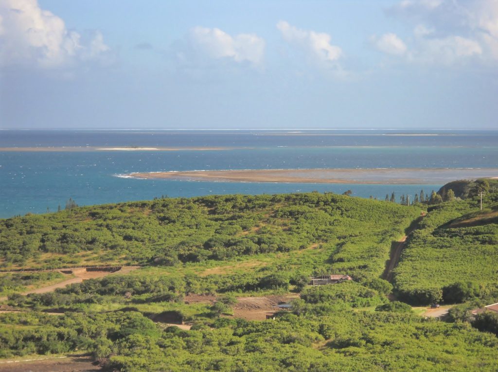
After bordering the sea, discover the bay of the department of Orne, Sensitive Natural Space of great wealth. This bay is a privileged refuge for migratory birds.
Considered an “easy” route, you can do it in a section of 7 or 14 km.
Norman Switzerland from the ridges
More challenging, this medium / difficult circuit runs 14 km on a route through the rugged landscapes Rocks of the Parks of the Norman Switzerland.
Touring the rocks of the Houle is imposed: from there is a point of takeoff from the paragliders but also offers beautiful views of the Orne River.
Department of La Manche
GR 223: The Customs Trail
As a GR, this route is very demanding and its 300 km must be overcome in stages, from the bay of Mont-Saint-Michel to the bay of Veys.
This road along coast still wild has many points of interest, such as the fort of Cape Lévi, the pink granite quarries, the Cape de la Hague and Nez de Jobourg, considered the highest in Europe.
And marvel at the meadows of the Havre de la Vanlée and the cliffs of Champeaux, called “the most beautiful kilometer of France”.
The Mortain waterfalls
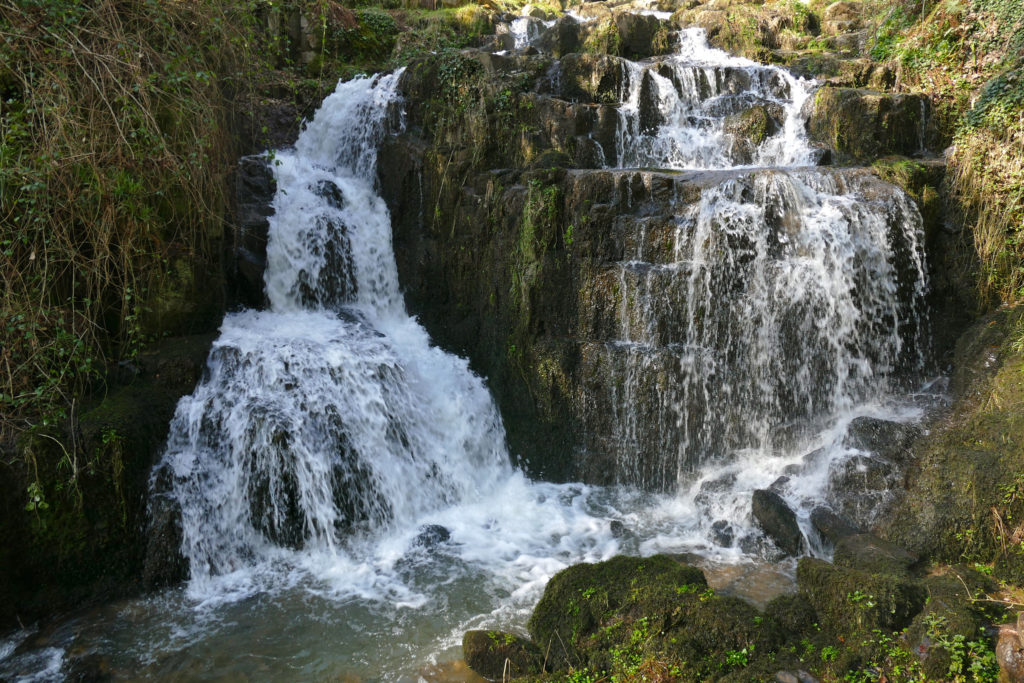
They are 7 km from medium to difficult level, but it is well worth traveling the way to admire more beautiful waterfalls in western France.
You can walk in 2 hours and a half, but reserve more time to enjoy your points of interest.
Don’t miss the Saint Evroult Collegiate Church, the White Abbey and the Saint Michel Small Chapel. There is also a 3.7 km circuit for families with children, to enjoy the adventure of this route.
Department of Orne
La Perrière: a town with history
With a medium difficulty and 10.5 km to cover in 3 hours, the route to Perrière is a celtic village of the past.
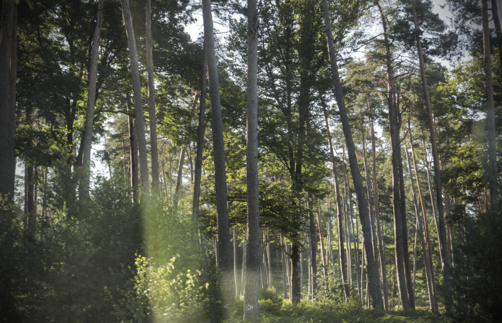
To reach it with the intact magic of a time travel, it is best to cross the Bellême forest, which runs over the slopes of the Perche.
In addition to admiring its majestic oaks, you can visit the Montimer Castle, the “Eperon” (the landscape from the Perrière church) and the School Oak.
Department of Eure
The blue fountains on the banks of the Seine
Joining two typical villages of the architectural style of the typical Normandy houses (Aizier and Vieux-Port), the Path of the Blue fountains is classified as difficult.
They are 2 hours and a distance of 7.2 km, zigzagging between the spectacular places of the Seine Valley; almost always in the shade of trees.
Following the Iton River
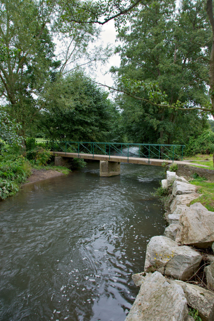
With an easy walk of 2.5 km to be traveled in a couple of hours, this route that follows the banks of the Iton River is ideal for your children to discover the fauna and flora of the humid media, for its 15 interpretation desks.
In addition to being declared a Sensitive Natural Space, the circuit shows you the Historic Monument of the castle of Chambray.
Department of Seine-Maritime
Towards the forest of Eawy
This route takes you from the Eawy forest through the country of Neufchâtel. It is a difficult and long route (30 km). So go prepared to make a stop in the arboretum of the garden of the King of Rome and follow the Chemin des Ecoliers to the Green Avenue.
In the sources of Bebec
With an average difficulty and 11.7 km, this route takes you to Villequier: a small town full of typical houses. In the cemetery near the church of Bébec, for example, stands an ordeal of the fifteenth century.
Nearby are its provincial forest and the birth of the river, sadly famous because Léopoldine Hugo, daughter of the brilliant writer drowned in its fountains.
Étretat Cliffs
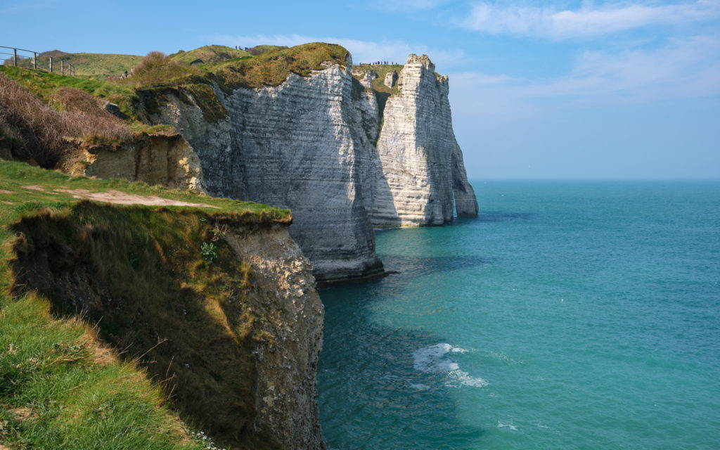
You could not miss in this list the Cliffs of Étretat, perhaps the most famous in the country and maybe worldwide.
They are near the town of the same name, and were the inspiration for artists such as Claude Monet, Eugène Boudin or Gustave Courbet. In his works a famous natural arch called “the eye of the needle” was immortalized.
The route is easy but long: 22.86 kilometers. It can be completed in about 6 hours.
Omaha Beach
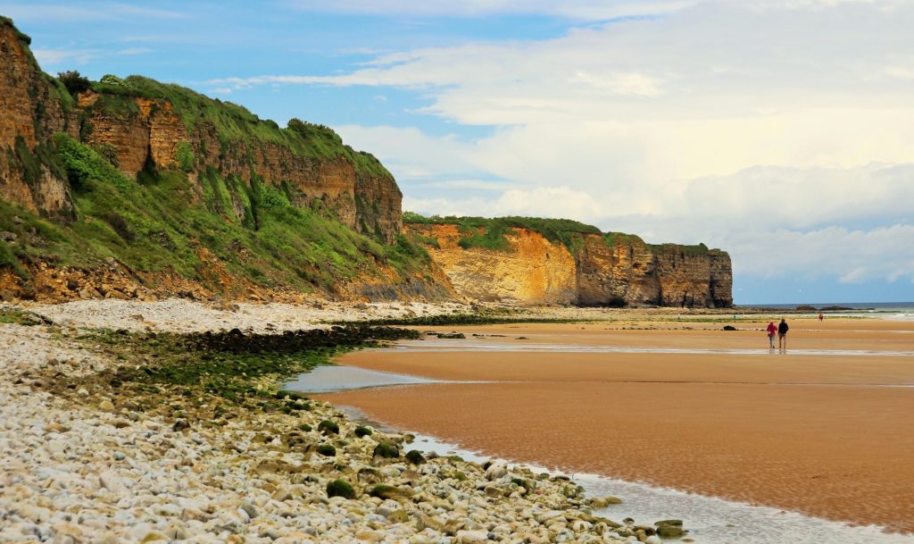
One of the points with more history of the geography of Normandy could not be missing in our list. The beach with the code name Omaha was the cruelest battlefield during D-Day, which opened another front in World War II.
The circular route includes Omaha Beach, the beach from Colleville to Saint Laurent and then returns through the American cemetery to honor the brave men who gave their lives for Europe’s liberation from the Nazi threat.
You can still see signs of the battle: a ship carrying tanks ashore and some German bunkers. The route is 9.11 km, is easy and can be covered in 3 hours and a half.
Of course, in this vast region these are just some of the options. If you have a preferred hiking route in Normandy and it is not on this list, we invite you to mention it in a comment so that the entire Walkaholic family benefits.
Who knows? Maybe we’ll meet on the road, discovering the routes of Normandy.
Apúntate a nuestra newsletter semanal
Te enviaremos un correo cada semana con el nuevo artículo junto a las novedades de nuestra app móvil de senderismo.