Hiking is one of the best options to get to know a country, enjoy and breathe its nature, enjoy its landscapes, its gastronomy and its culture. France is one of those beautiful places. From the Pyrenees to Brittany, from Alsace to the Massif Central, passing through Corsica and the Alps. This country is full of unique and memorable places to travel.
The French regions are full of hiking trails that offer geographic diversity and sublime landscapes.
In Walkaholic we have chosen some circular routes to enjoy France, as a group, family or by yourself.
Contents
Lac de Néouvielle, Valle de Aure
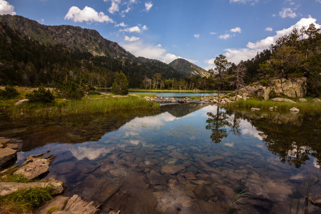
The route through the Néouvielle lakes is located in the Néouvielle Nature Reserve, on this tour you will discover 4 impressive lakes: Oredon, Les Laquettes, Aubert and Aumar. This reserve is a natural space of great beauty.
The route has a distance of approximately 10 kilometers with a duration of 5 hours, on a moderate level trail.
During the tour, you’ll border the main lakes of this nature reserve, when you reach the last lake, Aumar, you will enjoy a spectacular view of all the Pyrenees and the crystal-clear water of the lake next to the majestic Néouvielle peak. Which is 3,091 meters high.
In addition to its attractive landscapes, there is also opportunity to contemplate the rich fauna and flora that have as protagonists the black pine forests, different species of vascular plants, and emblematic animals such as the marmot, the grouse, the Red crossbill, the golden eagle, the griffon vulture, among others. A paradise for nature lovers!
Les Fenestrettes, Hérault
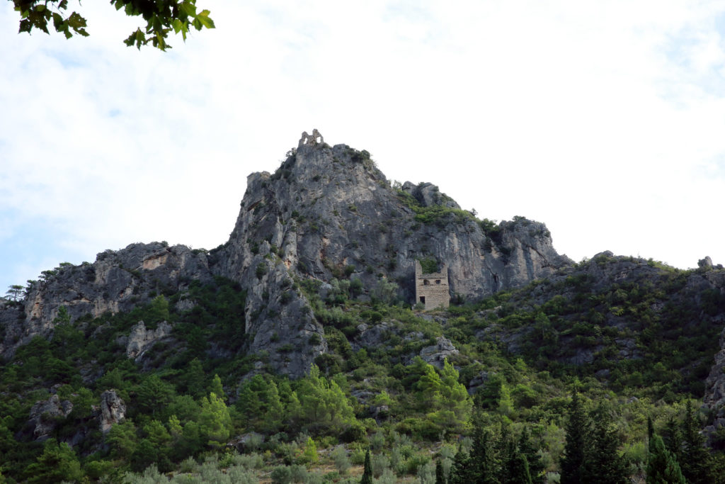
This route begins in the town of Saint Guilhem le Désert, called the Route of “Les Fenestrettes”. Thanks to a remarkable medieval work built by the monks of the abbey of Gellone, you can see the route of the path.
The road will take you to the Cirque de l’Infernet, a gigantic natural wall. The highest point of the circus is the ‘Max Nègre’ viewpoint, here the landscapes are stunning.
This route has about 10 kilometers with a medium difficulty, a journey duration of about 4 hours to get back to the town of Saint Guilhem le Désert.
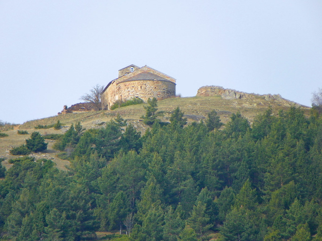
Turó de Bell-lloc, Dorres
If you are looking for an easy route to do with your children, this is a good option since the itinerary is simple and well-marked. The duration is about 1.5 hours with a total distance of approximately 5 km.
The Turó de Bell-lloc Route is included in the list of the 100 summits of the FEEC, when you reach the top you will find the old Romanesque church of Santa María de Bell-lloc declared a historical monument in France at the beginning 80s decade.
Although we propose to make this route from Dorres, you can also start it from Angostrina and Vilanova de Escaldes or even if you are on the side of Spain from Puigcerdà.
Puy de Lassolas and Puy de la Vache, Auvergne
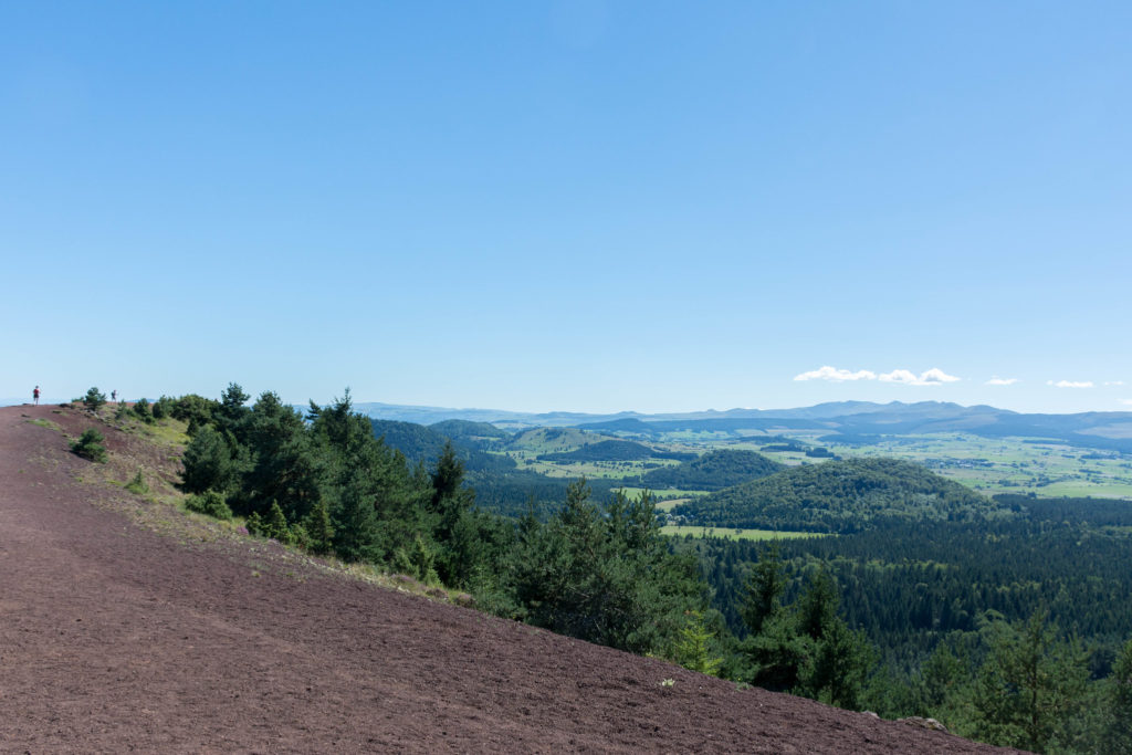
The Route of Puy de Lassolas and Puy de la Vache is a route that runs through 2 monogenic volcanoes, both with a volcanic cone that formed as a result of a single eruption.
The route has almost 5 kilometers and a journey of 2 hours approximately. Medium difficulty level. It starts at the “Maison du Parc des Volcans” on a tour where you will enjoy a unique landscape with mountains in reddish and black tones. The ideal season to do this trail is from March to November.
If you want to make a longer route you can choose to combine different trails that are in the Regional Natural Park of Auvergne where you can meet up to 80 volcanoes with roads for all difficulty levels.
Lac de Vouglans, Jura
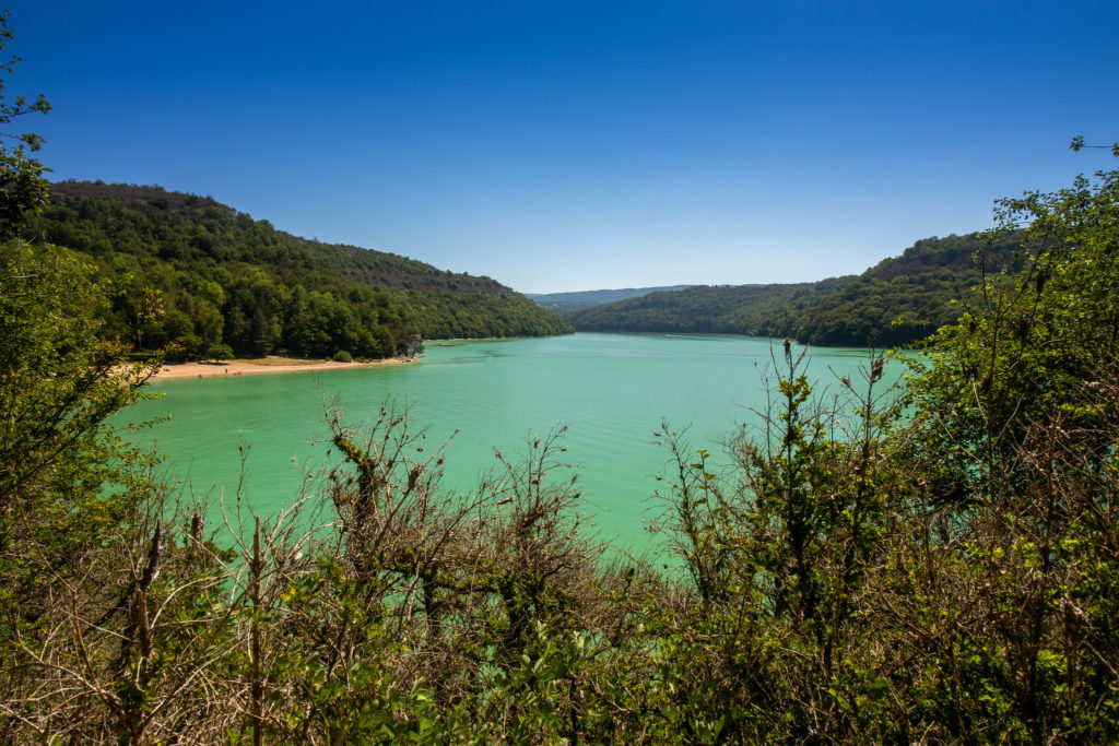
Lake Vouglans is the third largest reservoir in France, it is an artificial one and was created in 1968 with the launch of the Vouglans dam.
The reservoir is narrow and long, it is about 30 kilometres long and 900 meters wide. Its main attraction is its beautiful turquoise waters.
This circular route starts at the Surchauffant campsite with a journey of 15 kilometres approx. And a duration of 6 hours where you will find viewpoints and places prepared for bathing and sailing.
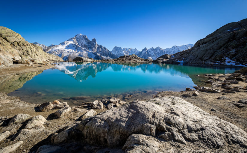
Aiguilles Rouges, Chamonix
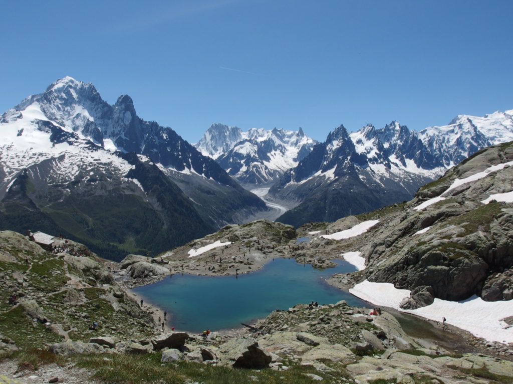
The Route of the Red Needles, is a circular route that goes around the Aiguilles Rouges massif. It is designed to travel in 3-4 days in which you will enjoy glaciers, lakes, forests, diversity of flora and wild animals.
The impressive views of this route will dazzle you, to give you an idea of the area: to the east of the massif are the summits of Mont-Blanc and to the west the sedimentary terrain dominated by the calcareous black rocks of Marga de Buet and the steep limestone cliffs (almost 1000m high) of the Fiz over the Anterne lake.
If you want to do the trekking in 3 days you can follow the next route:
Day 1. From Chamonix to Moede-Anterne. Start the tour in Chamonix to reach the Aiguillette des Houches, advance to Brévent where you can enjoy breathtaking views of the Aiguilles de Chamonix and Mont Blanc. Then descend to the Diozaz Valley, until you reach the Moede-Anterne refuge. They are about 19 km and approximately 6 hours long.
Day 2. From Moede-Anterne to Tré-les-Champs. They are 22 kilometers with a duration of 6-7 hours approx., On the way you will climb to Mount Buet at 3096 meters high. After a long descent you will reach Tré-les-Champs.
Day 3. From Tré-les-Champs to Chamonix. To complete this circular route on the last day you will travel 15 km in approximately 3-4 hours. Go up to La Tête aux Vents and the popular Lac Blanc, then continue the circuit until you reach Chamonix.
France is a country full of exceptional trails, from large routes to small trails to enjoy a few hours of nature, all of them full of landscapes rich in fauna and flora that allow you to enjoy these natural resources.
Making a circular route will help you better plan the route as you leave and arrive at the same place, which allows you to leave your car or stay at a hotel near the route if you want to enjoy the area for several days.
If you have any suggestion of circular routes through France, long or short distance, share them to discover the best corners of this country. We hope to see you on our next hiking trail.
Apúntate a nuestra newsletter semanal
Te enviaremos un correo cada semana con el nuevo artículo junto a las novedades de nuestra app móvil de senderismo.