Castilla y León may not be favored with a beautiful coastline, but since it is the largest region in Spain it is also full of interest for hiking enthusiasts.
Covering the Spanish part of the Duero basin, Castilla y León enjoys a surprising 94,226 km² full of trails and routes to discover.
Therefore, from Walkaholic we recommend 6 spectacular hiking trails in this region and invite you to discover them for yourself.
Contents
Castroviejo and Cueva Serena (Soria)

This route has approximately 6 km, with a low difficulty and it can be traveled in 2 hours more or less. It is an ideal path for family travel.
It begins in Duruelo de la Sierra, traveling 5 km along the GR 86 from the same town to Castroviejo, with a natural spring and a recreation area. This zone is really beautiful, thanks to the erosion that has shaped the rocks in capricious forms, which can be seen from a viewpoint protruding between a carpet of pine trees.
Serena Cave is reached from Castroviejo by the Raso de la Cespedilla (PRC-SO 71) or by a smoother path, which goes from the parking lot through a forest path. This cavern is one of the most interesting sites in the region, thanks to the fact that it contains a waterfall that freezes in winter and has an impressive flow in spring, after the thaws.
Another site of interest is the medieval Necropolis of the church of San Miguel, with graves dating back to the 9th century carved into the rock.
The Farm Road in the Monastery of Santa Espina (Valladolid)
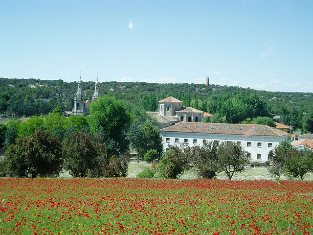
This 8-kilometer circular route can be traveled in just under 3 hours, beginning and ending at the Monastery of La Santa Espina in the town of the same name, in the municipality of Castromonte. It is suitable for the whole family, because it barely has a slope of 50 meters.
On this tour you can admire “La Granja”, a stone building that served as an agricultural center for Cistercian monks in the 12th century, as well as a quiet walk between poplars, pine groves, holm oaks and oaks. Any time of the year is good to explore it.
Of course, do not forget to complete the route with a visit to the Monastery of Santa Espina and the House of Nature.
Historic Community of Villa and Tierra de Pedraza (Segovia)
If you are one of those who like to hike the whole day, this circular route of approximately 25 km is perfect for you. With an estimated walking time of 7 and a half hours, you will start and end in Pedraza. This route can be done at any time of the year.
The route links the villages of La Velilla, Val de San Pedro, Requijada, Arahuetes and Pajares de Pedraza, so you can start from any of them. From Requijada take the road that leads to Arahuetes and continue to Pajares de Pedraza, then continue the march parallel to the Cega River, to La Velilla along the Fishermen’s Path.
We follow the route leaving mills and holm oaks behind, to connect with the route of the ‘Dehesilla Vieja’ to the vicinity of the Val de San Pedro. From there, we arrive at the hermitage of the Virgen de las Viñas.
Trail of the rock wineries in San Esteban de la Sierra (Salamanca)
This circular route named ‘Senda de los lagares rupestres en San Esteban de la Sierra’ in Spanish, has approximately 13 kilometers, and can be traveled in about 5 hours. It has a slope of about 300 meters, and begins and ends at the Cooperative Bodega of San Esteban de la Sierra.
It runs along a place full of cavities drilled in the rock for a long time by the hand of man, which are believed to serve as wine presses for pressing the grapes. However, the real purpose of these cavities has been lost over time. Other theories point out that they were used for tanning skins and even to perform pagan rituals.
Whatever the purpose of these cavities, the truth is that this walk is very pleasant and appropriate for any time of the year, because it runs between beautiful groves.
Trail of Las Salinas de Poza de la Sal (Burgos)
Located on the outskirts of Poza de la Sal in Burgos, these abandoned salt washes have been restored so that tourists know part of the region’s history.
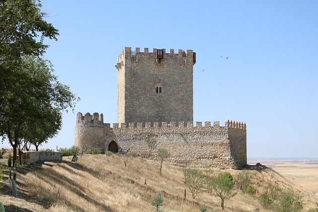
The trail of Las Salinas de Poza de la Sal is approximately 6 kilometers, beginning in the neighborhood of Los Corrales, to ascend to the largest diapire in Europe, with a height of 410 meters, passing through the Warehouse of La Magdalena to reach to the Poza Castle. From there, you can take some excellent photos of the town and the region of La Bureba.
The complete route can be traveled in 2 hours, with a medium-low difficulty, but it is not recommended to deviate from the path since in the surroundings there are wells and salt mines in ruins that can put you in a bind.
El Roblón de Estalaya (Palencia)
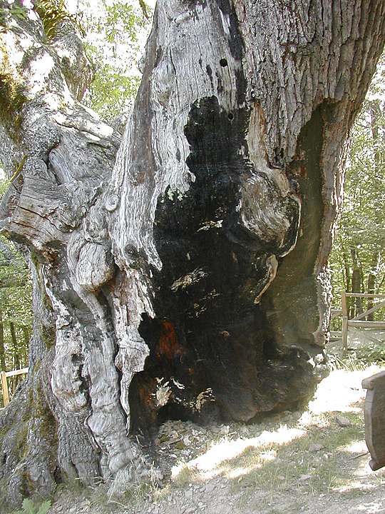
For a pleasant and familiar walk through the Palencia Mountain, we recommend this circular route of approximately 4.5 km. Of low difficulty, it has only 100 meters of slope.
In an hour and a half you can travel it. We leave Cervera de Pisuerga taking the road towards Potes, and after passing the bridge over La Requejada reservoir and leaving Vañes behind we take the road to the right, and after 2 kilometers we reach the starting point of the route.
The attraction, of course, is to reach the legendary Albar oak (Quercus petraea) of Monte de Estalaya, which gives its name to the route. He is also called “The Grandfather”, due to its age, its 12 meters high and its 9.8 meters perimeter. It is estimated that it is about 500 years old and is the oldest of its kind in the entire peninsula.
Of course, this is just a very quick overview of everything that Castilla y León saves for the enjoyment of hiking enthusiasts. If your preferred route is not included in our list, then leave us a comment so that the rest of our community benefits from your knowledge.
Who knows? Maybe one of these days we are on the road, visiting the best hiking trails in Castilla y León.
Apúntate a nuestra newsletter semanal
Te enviaremos un correo cada semana con el nuevo artículo junto a las novedades de nuestra app móvil de senderismo.