
The power of volcanoes is one of nature’s most overwhelming forces, capable of radically transforming the landscape. In Spain, we also have our variety and dose of these volcanic and exceptional mountains.
If you are looking forward to enjoy landscapes that seem out from another planet and shocking contrasts, in Walkaholic we have gathered for you 9 routes through the volcanoes of Spain. A top and unforgettable experience for volcanic tourism lovers.
Contents
Los Campos de Calatrava (Castilla-La Mancha)
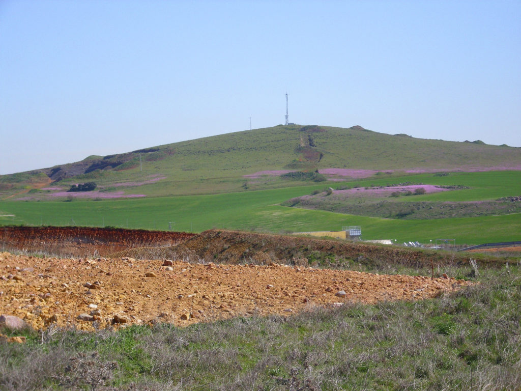
The volcanic region of “Campo de Calatrava” is located in the province of Ciudad Real, on these fields the volcanic lagoons alternate with extensive areas of Mediterranean forest next to pastures, cultivation extensions and grazing areas.
Along this area, the volcanic activity originated the rise of magma through fissures, that when coming into contact with aquifers and groundwater gave rise to craters and depressions (called maares), creating volcanic plains.
These places are full of life and they’re natural habitat of birds, amphibians and invertebrates. Integrated by a system of 16 lagoons where La Inesperada in Pozuelo de Calatrava, La Hoya de Cervera in Almagro, and La Laguna de la Alberquilla stand out. This latter one is a natural monument too.
Cancarix (Albacete)
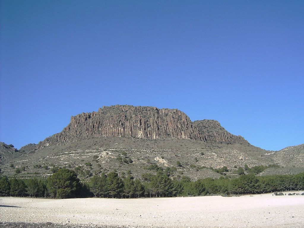
“El pitón volcánico de Cancarix” is located in the municipality of Hellín in Albacete and it has the title of Natural Monument.
It is the only volcano on the Iberian Peninsula who’s top and chimney has been exposed, forming a steep landscape with a forest of “carrascas” on top. The escarpments are home to numerous birds that nest in the walls. Another peculiarity of the Cancarix is the abundance of rocks called “jumillitas”, exclusive to the place.
This volcanic dome is estimated to have emerged about seven million years ago, its summit can be reached by two routes that will allow you to enjoy a wonderful landscape during three hours of walking.
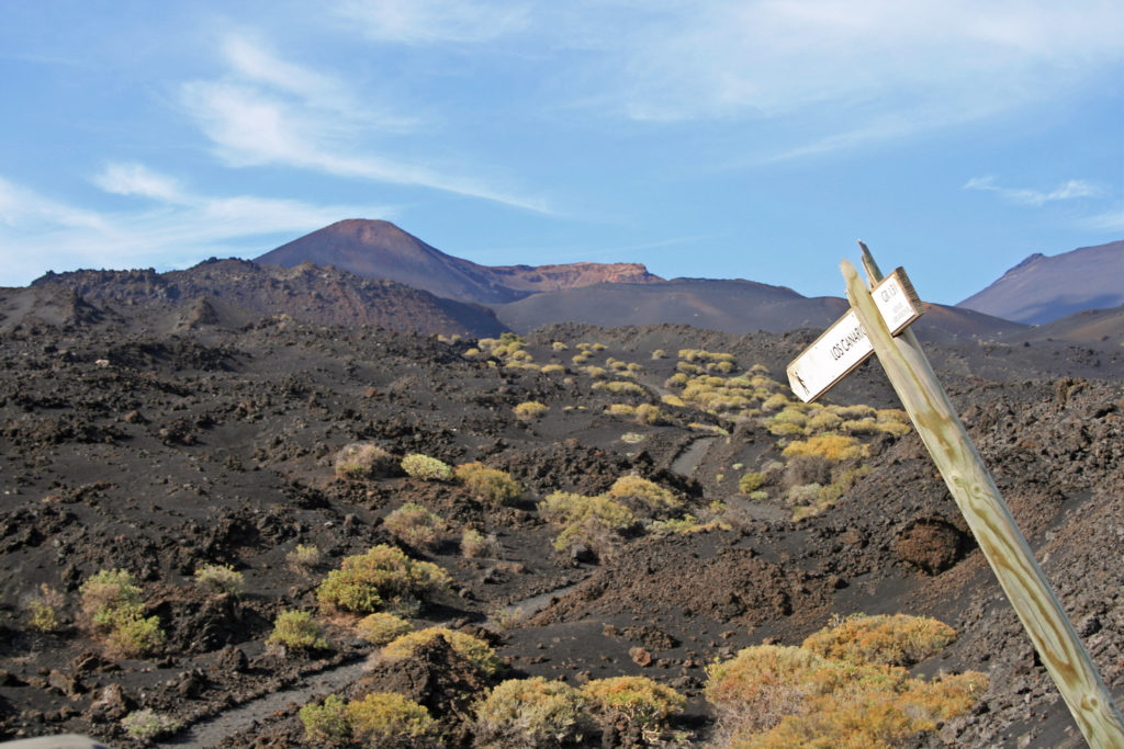
El Teide (Tenerife)
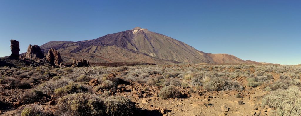
This list would never be complete if we do not talk about the largest volcano and elevation in Spain with its 3,718 meters of altitude, and the third in the world. In addition to its unique volcanic cones, craters, chimneys, and lava flows to discover on the route of the Teide Viewpoints.
It is located within the Teide National Park, declared a World Heritage Site by UNESCO in 2007. It is an essential visit for anyone who goes to Tenerife.
The Teide’s peak can be climbed on foot or by cable car, depending on your available time and physical capacity.
La Garrotxa (Girona)
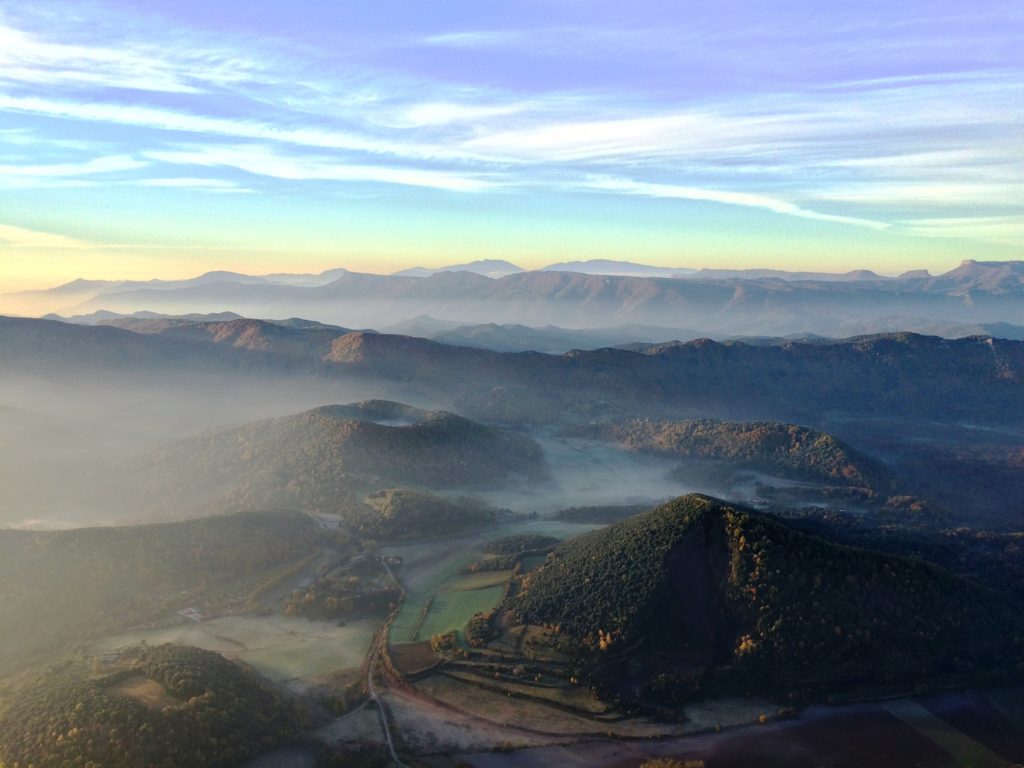
This is a unique volcanic area of basaltic lava flows. “La Garrotxa” hides about 40 craters among the vegetation of the place.
To hike it, you can follow a circular path of 10 km, which begins and ends in the “Can Serra” area. Along its route you can visit the “Fageda d’en Jordà” that grows on the “El Croscat” volcano, the largest cone in the Iberian Peninsula. Another area of interest is the Santa Margarida volcano, within whose crater a chapel of the same name was built.
All these wonders are protected by the natural park of the Garrotxa Volcanic Zone, with its 12,007 hectares is the largest in the Peninsula. The previous route is only one of the 28 itineraries to walk on foot in this park.
L’Illa Grossa (Castellón)
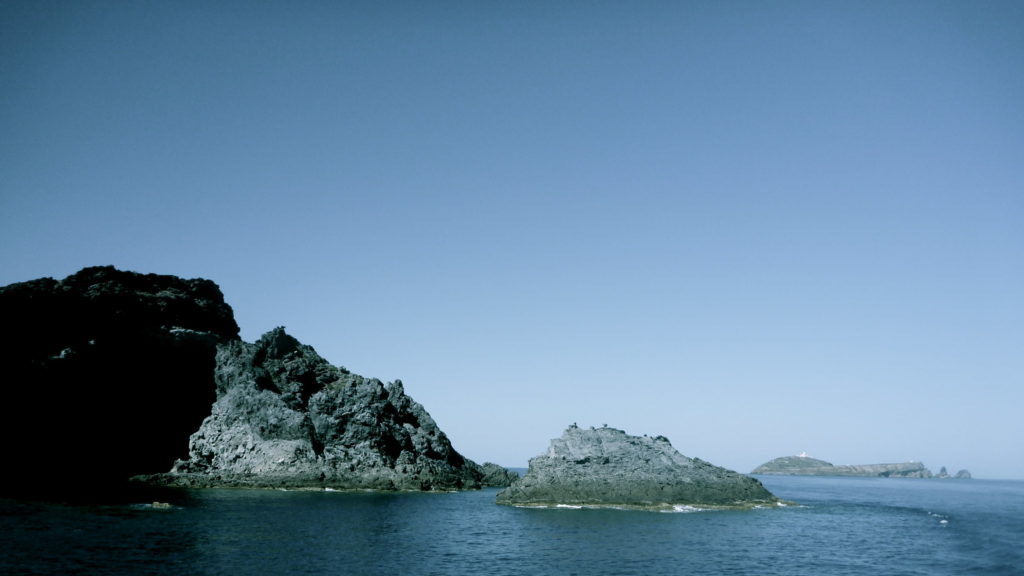
The “Islas Columbretes” are four volcanic islands that occupy an area of 19 hectares, with numerous craters and one extinct chimney.
The largest, l’Illa Grossa, is approximately one kilometer high and it is an old crater. At one of its sides there is a lighthouse at 67 meters altitude. You can wander the island on guided tours of an hour and a half.
Bandama boiler (Gran Canaria)
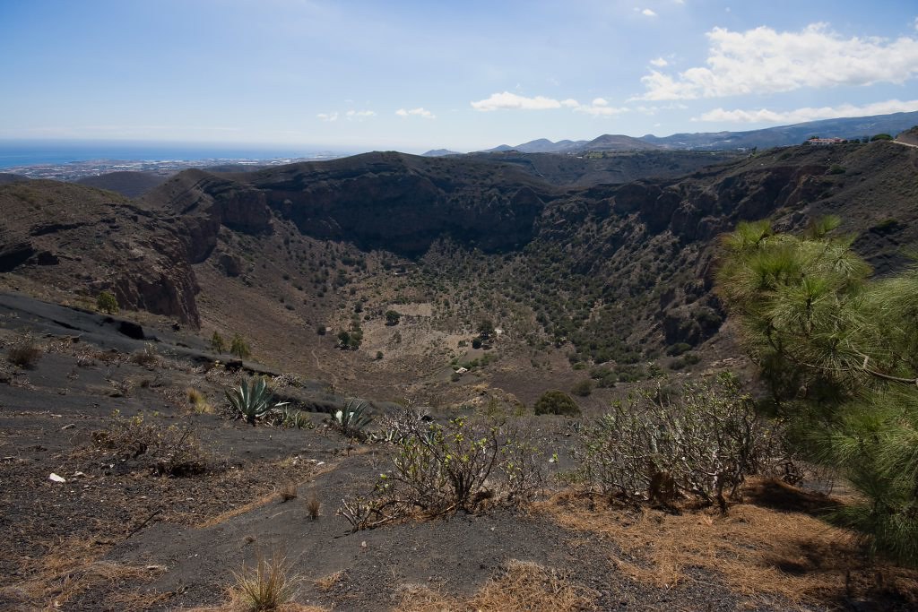
If you enjoy volcanic tourism, visiting “La Caldera de Bandama” is a good choice. Located to the northeast of the island, in addition to the “Pico de Bandama”, they conform the natural monument of Bandana.
Its boiler is about 200 meters deep and 1,100 meters is the diameter of the upper edge of this natural beauty. You can walk along different paths that line the boiler or you can go down to the bottom of it if you’re feeling adventurous.
Rodalquilar (Almería)
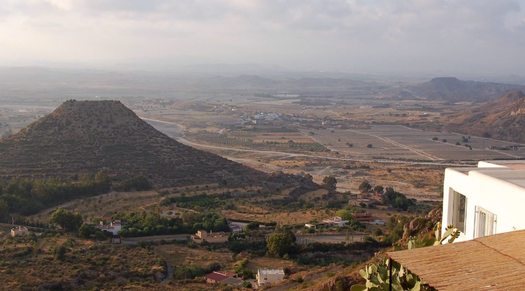
Visiting the Cabo de Gata-Níjar Geopark is to enjoy a system of 16 trails perfect for volcanic tourism and great to learn more about the geology of the region.
This is one of the most peculiar coastal bounds in the Mediterranean, which protects 375 square kilometers of land and 120 square kilometers of sea. In the Geopark stands out the volcanic “Caldera de Rodalquilar” in Playazo.
Timanfaya (Lanzarote)
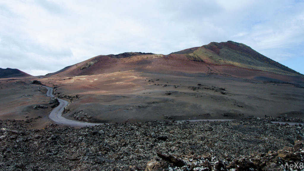
The volcanic eruptions that took place in this area in the 18th century buried a quarter of the island in ash and lava.
The area is protected by the Timanfaya National Park, with 5,000 hectares. To get to know it there are several options, from touring it on a camel, by bus or going naturally by hiking the volcano through different routes, where you will contemplate different types of lava and craters.
Volcanes de Teneguía (La Palma)
To finish our list, nothing better than talking about Teneguía, one of the last to erupt in 1971. This fact not only radically transformed the landscape, but also increased the surface of the island.
To explore the area of the volcanoes, the best way is to reach the visitor center of the San Antonio volcano. From there you’ll be able to choose and take several routes, not only to the volcano itself but also another that leads the arid landscapes towards the Fuencaliente vineyards, ascends to the Teneguía ridge and culminates in the Lighthouse and the Salinas de Fuencaliente.
There are more routes to enjoy the volcanoes of Spain that you can enjoy and travel. If your favorite is not on our list, leave us a comment so the whole community can benefit from your experience.
So, we only have to put on our boots, prepare the camera and go on these 9 routes through the volcanoes of Spain. Who knows? We may meet very soon on the road.
Apúntate a nuestra newsletter semanal
Te enviaremos un correo cada semana con el nuevo artículo junto a las novedades de nuestra app móvil de senderismo.