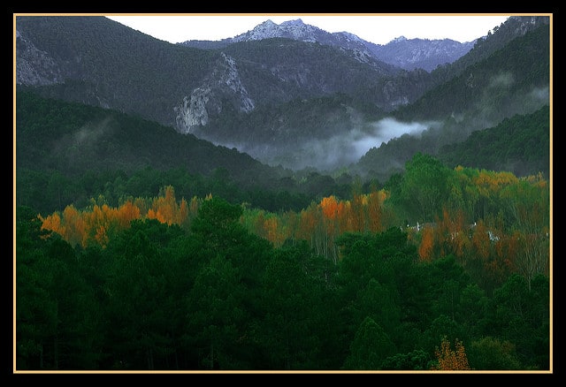
Hiking Sierras de Cazorla can be perfect for a weekend, or for an exigent multiday trek. In the inner province of Jaén, in Andalusia, we found one of the most well renowned natural parks of Spain. The Sierras de Cazorla, Segura y Las Villas Natural Park. And in the heart of this natural paradise, there is the long GR-247, or “Bosques del Sur” track, which is divided in 21 main stages.
Contents
Fauna and flora spotted while Hiking Sierras de Cazorla
Here you can enjoy of the very beginning of the Guadalquivir river. A varied range of wild animals like:
- Deers
- Mountain goats
- Wild boars
- European mouflon
- Fallow deer
- Griffon vulture
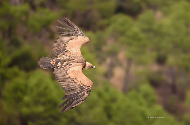
Hiking Sierras de Cazorla – Volture ( Ramón Portellano CC BY 2.0) - Golden eagle
- Bearded vulture or ossifrage
- Spanish algyroides or Valverde’s lizard
- Foxes
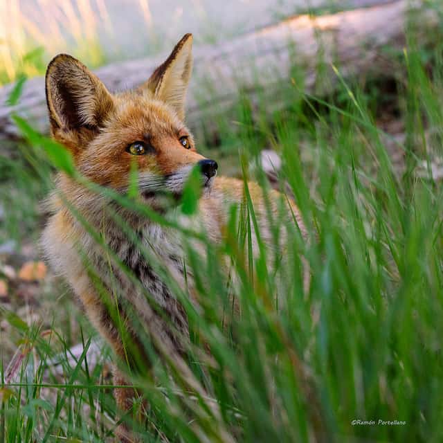
Hiking Sierras de Cazorla – Fox ( Ramón Portellano CC BY 2.0)
This natural park, which is the largest pine forest area in the whole Spain, is also home of plenty of plants and trees. This is an approximate list of what you could find over there:
- Endemic species of Cazorla:
- Cazorla violet
- Cazorla geranium
- Cazorla columbine
- Two species of narcissus
- Carnivorous butterwort Pinguicula vallisnerifolia
- Pine trees, as mentioned earlier:
- European black pine, which is the most common in the region
- Alepppo pine
- Maritine pine
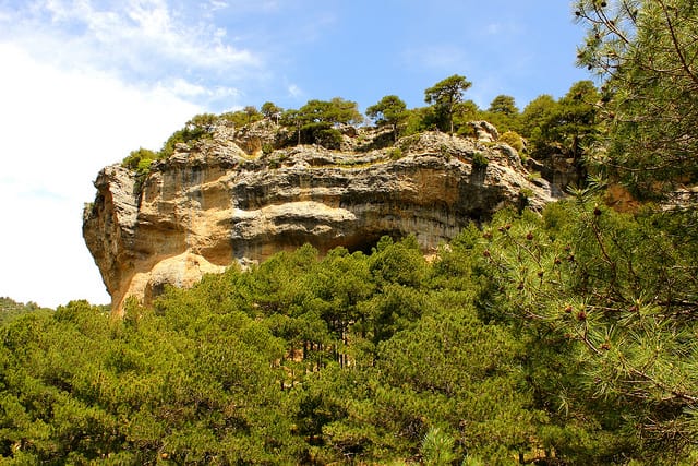
Maritime pine – Sierras de Cazorla ( Jorge Cancela CC BY 2.0)
- Strawberry trees
- Mastic
- Different oak trees:
- Holm oak
- Portuguese oak
- Gall oak
- Yews
- European holly
- Ash
- Willows
- Poplars
- Reeds
- Cattails
Tracks Bosques del Sur (GPX, KML and XLS files) – Hiking Sierras de Cazorla
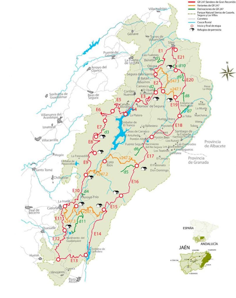
In the official website of the Bosques del Sur track, you can find the complete list of the stages in different formats (GPX, KML and XLS files). However, here is an image so you can see the different stages more clearly.
Where to sleep on each stage
You could look for towns near the end of each stage, and find conventional accommodation options. Or sleep in free shelters and free campsites. In this map you can find some of the shelters, marked as “Refugios de pernocta” in Spanish. They are supposed to be used only for hikers, and not for people who get to them by car.
We have made you a list of free shelters and free campsites that we know you’d appreciate if you are considering to do this trek.
Free shelters and campsites in Sierras de Cazorla
Some of the shelters are a little bit out of the hiking Sierras de Cazorla, but you’d find them quite handy. Most of them are basic shelters, with a surface where to sleep (not a mattress), a table and somewhere to sit. Many of them even have a fireplace, that would be very useful in winter. Most of the campsites are free to use, although not all of them. Check the links we provide here in order to know for certain.
Stage 1 / Peña del Olivar – Segura de la Sierra
The first night there won’t be any shelter or campsite where to sleep near Segura de la Sierra. You could walk a little bit further though, until El Robledo if you wish. There are some traditional options in Segura de la Sierra though.
Stage 2 / Segura de la Sierra – Refugio CF El Campillo
The second night, the idea is to sleep at Refugio El Campillo, which is a free shelter with drinking water and a fireplace.
This stage of the track would be a transition from the lower mountain to the upper mountain part of the national park. The shelter is at 1487m above the sea level.
Stage 3 / Refugio Casa Forestal de El Campillo – Hornos de Segura
The 3rd evening you’d reach to the town Hornos de Segura. If you intend to sleep in a shelter or a campsite, keep walking a little bit further. Otherwise, you could find some options where to sleep here.
Stage 4 / Hornos de Segura – Área Recreativa Los Parrales
This day would be a short one, around 9km to walk from Hornos de Segura to the campsite Montillana, where you could put your tent for a very low price. Or you could sleep in any of the following free shelters, but bare in mind you need to walk much further:
- Caseta de la Bandera: https://www.walkaholic.me/en/shelter/spain/andalusia/jaen/120-caseta-de-la-bandera
- Refugio Risca del Guijarrón: https://www.walkaholic.me/en/shelter/spain/andalusia/jaen/121-refugio-risca-del-guijarron
Both free shelters have a fireplace, being the second one the closer to the river Guadalquivir, and the lake Tranco de Beas.
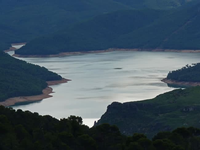
Stage 5 / Área Recreativa de Los Parrales – Casa Forestal Hoya de los Trevejiles
For this day, you would be able to enjoy many beautiful views from the lake and the mountains surrounding it. This stage would be around 18km.
Halfway route, you will be very close to the shelter “Refugio Risca del Guijarrón”. The one we mentioned in the previous stage.
The end of this stage, “Casa Forestal Hoya de los Trevejiles” is not suited for sleeping inside. So we suggest walking a bit further further the day before, stage 4, and sleep in the shelter Refugio Risca del Guijarrón.
For stage 5 we are not able to tell you where you could sleep. Perhaps you could plant your sleeping tent somewhere around and out of the track. Of sleep in your sleeping bags out in the forest.
Stage 6 / Refugio C.F. Hoya de los Trevejiles- ZAC Fuente de los Cerezos
15km away from the end of this section of the track. For this day, we will have a controlled area where to put our tents, that even has a barbecue area. The free campsite is “Zona area controlada – Fuente de los Cerezos“.
Stage 7 / Zona de Acampada Controlada Fuente de Los Cerezos – Refugio Casa Forestal La Parra
Day 7 in Bosques del Sur hiking track. For today we will be going from a campsite, to a free shelter that is at 1063m of altitude. The shelter is “Refugio Casa Forestal La Parra“, and has bunk beds.
Stage 8 / Refugio Casa Forestal La Parra – Refugio Majalserbal
From shelter to shelter for the 8th day. It’d be a a pleasant stay at “Refugio Majalserval“, with fireplace and grills.
In the area, there’s another shelter though, at 1668m, the “Refugio de la Morra del Cerezo“, could be a cold place where to spend an evening. Deteriorated, but definitely it has a roof and 4 walls, enough for a mild weather evening.
Stage 9 / Refugio de Majalserbal – Refugio Casa Forestal de La Zarza
Stage 9 would leave us at the “Refugio Casa Forestal de La Zarza” shelter, a bit cosy although totally functional. It even has water and fireplace. Worthy to mention, that there’s an alternative 3km track that starts at this shelter where you could enjoy of a fantastic panoramic view.
Stage 10 / Refugio Casa Forestal La Zarza – La Iruela
Officially, the stage 10 ends up in La Iruela, a town next to Cazorla. Where you could sleep at the campsite “Camping Cortijo San Isicio“.
If you are willing to avoid towns, and prefer a shelter where to sleep, then you could go to “Refugio de Sacejo“, which is a big enough shelter for 8 people. It’s near Vadillo Castril, where another campsite awaits for you, paid one this time, “Complejo Turístico Puente de las Herrerías“. Here, you could sleep in a paid shelter as well, or a wood cabin.
Stage 11 / Cazorla – Refugio Casa Forestal Collado Zamora
Either if you start from Cazorla, or from the “Refugio de Sacejo” or from “Complejo Turístico Puente de las Herrerías”, you will have a similar distance to reach the free shelter “Refugio Casa Forestal Collado Zamora“. Approximately 13-15km.
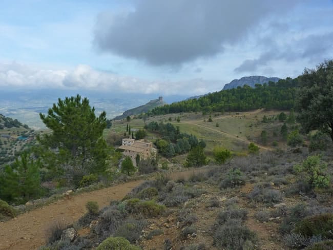
I would recommend you not to miss the source of the Guadalquivir river, which is close from there.
Stage 12 / Refugio Casa Forestal Collado Zamora – Belerda
Quite a long day, compared to the previous ones. 18km separate us from the destination, at Belerda. That’s where the Stage 12 is supposed to take us. But again, we have a proposal for you, so you could sleep in a shelter. “Refugio Caseta Cabanas” is located at 2031m of height. This time, we cannot guarantee that you’d a comfortable shelter, since we haven’t slept there yet.
If you go to Belerda, you will find a 200 people town with a supermarket, a pharmacy and most probably somewhere to sleep.
Stage 13 / Belerda – Aula de Naturaleza El Hornico
In the area where you are supposed to finish this stage, you’d be able to sleep in campsite La Bolera. Next to the river Guadalentín.
Stage 14 / Aula de Naturaleza El Hornico – Refugio Casa Forestal Fuente Acero
Stage 14 puts us back on track and lets us return to the heart of the national park. For this day we have the possibility to sleep at the free shelter “Refugio Fuente de Acero“. Equipped decently for a free shelter, and with fresh water at only 100m of distance.
In the region, there is another free shelter, “Refugio del Buitre“, but it’s in a poor condition. However, it will be a good point where to sleep, if we intend to do the ascent of the Cerro del Buitre (2021m).
Stage 15 / Refugio C.F.Fuente Acero – Refugio Rambla Seca
Short day, since the distance that we need to walk until we reach the shelter “Refugio Rambla Seca” is of only 11,5 km. There would be little elevation gain as well.
Stage 16 / Refugio Rambla Seca – Refugio Campo del Espino
This part of the track would provide us with plenty of options where to sleep and get deviated if we are willing to. If we want to explore the surroundings of course. The official track takes us to the free shelter “Refugio Campo del Espino“.
And if you want to give a chance to the alternate tracks in the area, like D5, or v247.2, then you could sleep in any of these shelters as well:
- Refugio Collado de la Paja
- Refugio Monterilla
- Refugio Cañada Mergosa
- Refugio Cañada del Rincón
- Refugio Banderillas (viejo)
- Refugio Banderillas (nuevo)
Be sure to measure the distances in advance, and check the map thoroughly.
Stage 17 / Refugio Campo del Espino – Pontones
From the shelter “Refugio Campo del Espino”, we will be getting to Pontones, which is actually 2 towns, Pontón Alto and Pontón Bajo. Here there would be somewhere to sleep, at least a shelter, “Refugio del Segura”, which is more like a rural complex with different apartments.
Stage 18 / Pontones – La Toba
You could get today to the town La Toba, which is next to the lake “Embalse de Anchuricas”. Although, if you wish to continue sleeping in shelters, there is one, “Refugio Bodegón los anchos“, that is on a track that will direct us anyway to the north. It’s up to you clearly.
Stage 19 / La Toba – Prado Maguillo y Refugio Casa Forestal El Bodegón
Well, this is the shelter we talked about in Stage 18. You can come here, through a different track and avoid getting into La Toba. Although going to La Toba could come in handy to get some food.
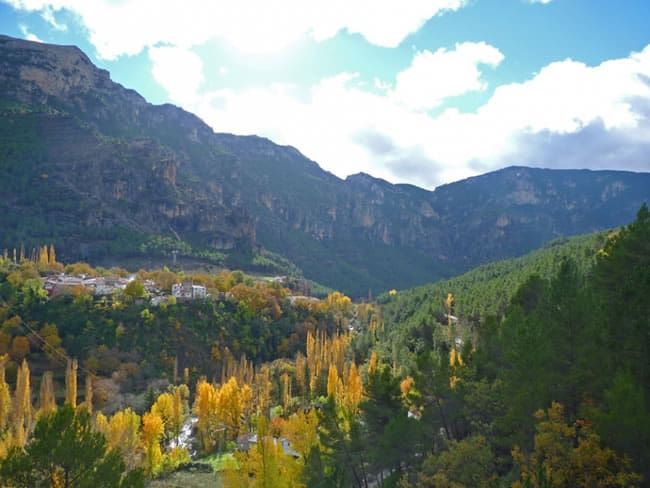
Stage 20 / Prado Maguillo y Refugio Casa Forestal El Bodegón – Refugio Era del Fustal
There would be 3 options where to spend this night, if we stick to the GR-247 track:
- The official option, “Refugio Era del Fustal“, which is the best equipped option
- Caseta de Navalperal (sometimes closed)
- Zona de Acampada las Acebeas (the campsite)
Stage 21 / Refugio Era del Fustal – Área Recreativa Peña del Olivar
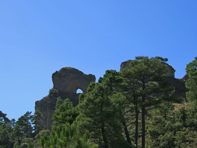
And we finish the Hiking Sierras de Cazorla, “Bosques del Sur”, or GR-247 track back in Siles. Before getting to Siles, there’s a campsite, “Camping Río los Molinos” that you might want to check if you want to sleep in your tent.
Alternative routes
- The lake “Laguna de Aguas Negras”, next to the source of the river Borosa, it’s an excellent option for a deviation.
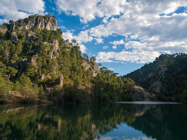
Hiking Sierras de Cazorla – Laguna de Aguasnegras (Luis Daniel Carbia Cabeza CC BY 2.0) - Next to the previous lake, there is the waterfall “Salto de los Órganos”, which is breathtaking
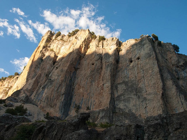
Hiking Sierras de Cazorla – Salto de los Organos (Luis Daniel Carbia Cabeza CC BY 2.0)
We hope you enjoyed of the Hiking Sierras de Cazorla. Feel free to drop any comment, and let us know about any misleading information about the campsites, the shelters or the route itself. Although we are more focused on providing sleeping arrangements, it’s great if we can provide of more accurate information to other hikers.
Apúntate a nuestra newsletter semanal
Te enviaremos un correo cada semana con el nuevo artículo junto a las novedades de nuestra app móvil de senderismo.

Hi,
when in spring is a good moment to not face relevant amounts of snow anymore, but enjoy a fresh, lush, first green – but on the other hand no heat yet?
Thanks!
Hi and apologies for the late reply,
Both April or May are good months to come to this area. There is usually no snow in spring. I’d suggest you to go there in April, since 2nd half of May could be a bit too hot.
Have fun!
No worries, so thankful for all the helpful info on here!
I’ll probably just have a couple/few days in the end – what’s your favourite section?
Eye candy is a huge driver for me, also rather remote single trails as opposed to beaten, wide paths.
I’ve been in the Rio Borosa/Embalse aguas negras/Iruela/Arroyo frío área already.
Thanks!
Back from the GR – have to say I didn’t like it much, doesn’t serve justice to this beautiful piece of landscape.
WAY! too much dirt roads for hours and hours!
Though also a heads up on the huts – the infos might be quite dated by now.
Las Banderillas for example is far from the described state.
That far that I – when arriving after dawn – was seriously doubting if I just hadn’t found the described ones in the dark somewhere near.
The little one with broken, somehow stuffed windows is not more thant an absolute emergency place – and the big one not much more. no beds, apartment style whatsoever. a run-down, empty place, providing shelter on a naked hilltop.
First of all, thank you for updating us all about the state of the shelters.
It’s certainly sort of a lottery about the status of the shelters. Not the first time (nor the 10th) that I see a shelter more as an emergency shelter than a proper one.
I have myself been in just a few of the shelters of this GR. However we intend to keep this information as up to date as possible.
If you have more detailed information about them, pictures or whatever you think is helpful, I’d be more than glad to complete them with your information.