Summer is the season that comes with high temperatures and scorching sun. Although these conditions do not frighten a well-prepared hiker, it is also true that, to make the day more fun and fresh, there is nothing better than walking on routes with water nearby.
The proximity of the precious liquid tends to cool the environment and make the heat more tolerable, as well as being an accessible water source to combat dehydration, if all necessary precautions are taken to make it drinkable.
Of course, not all are practical advantages: waterfalls, rivers and lagoons in perfect harmony with the environment are places that attract a very interesting flora and fauna, as well as being the perfect frames for the most beautiful photos.
For all these reasons, from Walkaholic we propose you interesting and beautiful routes with water to be traveled this summer, that we are sure that you will enjoy them a lot.
Contents
?Laguna Negra de Urbión (Soria)
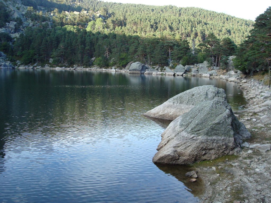
It is part of the Laguna Negra Natural Park and the Urbión Glacial Circles and is only 20 km from Vinuesa. It is one of those magical places where the glacier water has done wonders in the high mountains, and there are plenty of streams, waterfalls and dreamlakes to be enjoyed.
We recommend especially the ascent to the Urbión, starting from the Black Lagoon. It is a lake of glacial origin at 1753 meters of altitude, with dark waters and surrounded by high rocky walls.
The Laguna Larga is then bordered and pine forests and waterfalls are crossed to conquer the Urbión Peak. If you want to continue seeing water, you can deviate to visit the source of the Douro River.
This complete route is linear, easy and well signposted. Its 10 kilometers in length can be completed in about 5 hours, with a slope of 500 m.
?Cascada de Colores (La Palma Island)
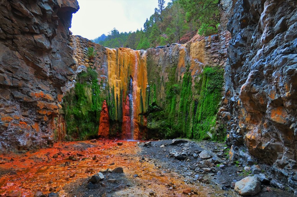
The island of La Palma is home of the Caldera de Taburiente National Park. There you can enjoy the unique spectacle of the Cascade of colors.
It can be accessed from the park at the bottom of the Barranco de las Angustias, then go to the viewpoint of the Brecitos and take the path downhill. In total, it is a route of approximately 7 hours, well signposted and without dangers.
After this fascinating walk, you will reach this dream waterfall with water dyed green, ocher, orange and yellow: one of the proofs that the earthly paradise exists.
?Ruta por la costa de Isla (Cantabria)
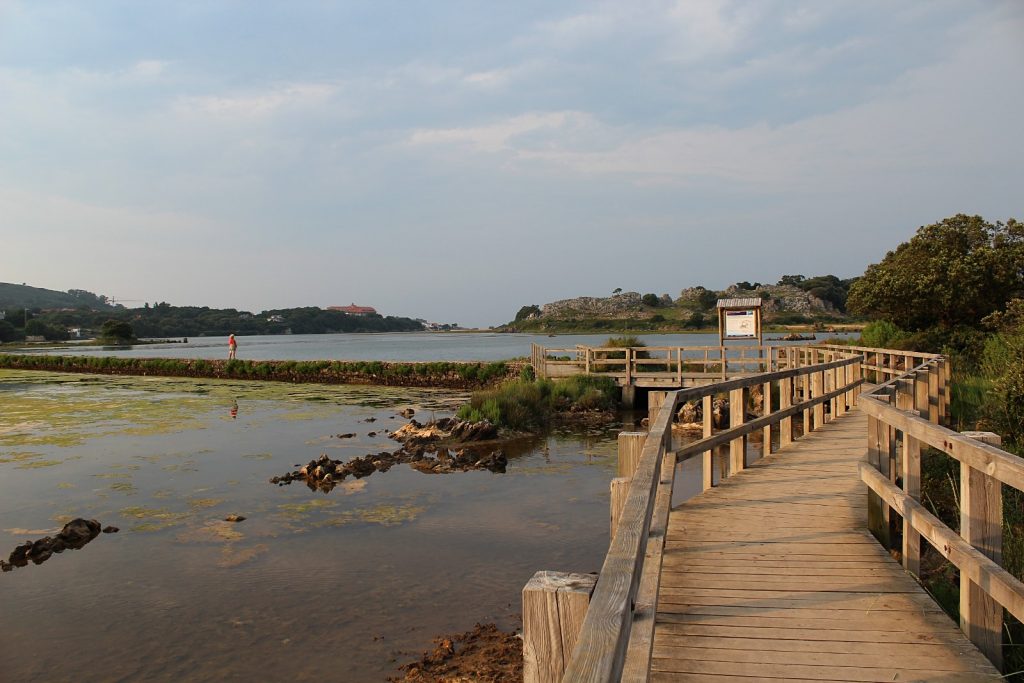
If we talk about routes with water to enjoy the summer, it would be unforgivable not to mention some of the paths that run along the sea. For this occasion, the route along the coast of Isla offers us about 10 kilometers through the coast of this town of the municipality of Arnuero.
Starting from the Ajo estuary, the mouth of the Campiazo river to the Cantabrian Sea, and ending in the Joyel marshes, a space declared Natural Park, the path runs through cliffs, golden sand beaches and the blue sea.
The beauty of Isla makes it a real tourist attraction during the summer months, but few brave dare to face this path reminiscent of the places of Scotland and Ireland.
?Chorro Grande (Segovia)
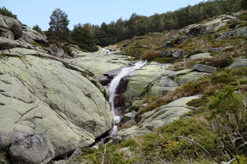
Located in the Guadarrama National Park north of Madrid, it can be reached from the urbanization Caserío de Urgel, in San Ildefonso. This route is easy and very appropriate to be travelled with children.
Although it is not signposted and its bifurcations are not too evident, it is fortunate to be a popular and crowded path. Therefore, any other hiker can offer you directions, in addition to having GPS and maps that we offer you in our Walkaholic app.
This path is great for summer, because it runs in the shade of pines and oaks until you reach this great waterfall of more than 100 meters high, dividing in two the stone wall from which it springs and doing honor to its name.
The view is magnificent from below, but it can also be seen from the waterfall: there is a small path that leads to it.
?Cañón del río Lobos (Castilla y León)
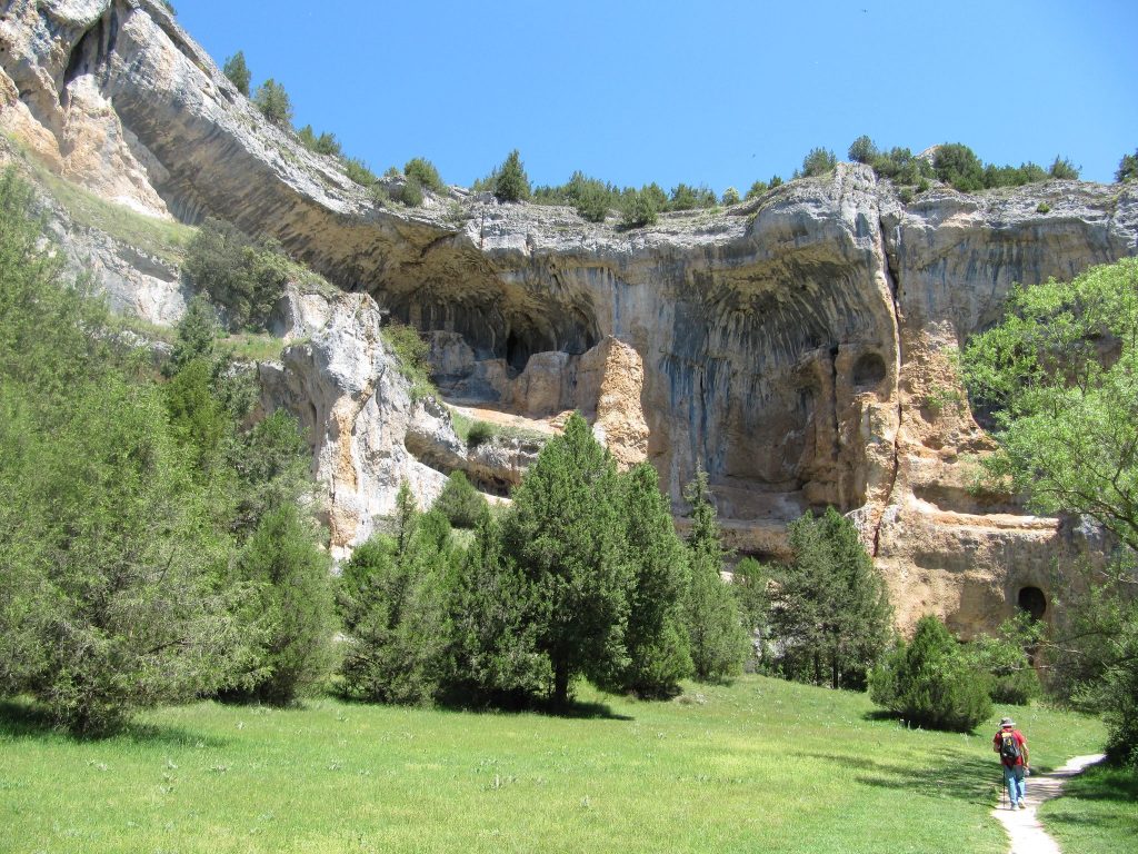
Located in the northwest of the province of Soria, this canyon is located in the separation between the foothills of the Iberian Range and the high plateau of the Duero. During its 25 km route (almost flat and that can be done in several stages), the Cañon del Río Lobos joins Ucero in Soria, and Hontoria del Pinar, in Burgos.
We propose you to start at any of the car parks of the Cañón del Río Lobos Natural Park: the Cueva Fría or the Valdecea. You can make short routes, such as the route to the hermitage of San Bartolomé or prepare for the longer routes and travel around the Canyon in its extension and enjoy beautiful views of the river and the entire Natural Park. All the trails of the Canyon are well signposted.
?Nacimiento del Río Mundo (Albacete)
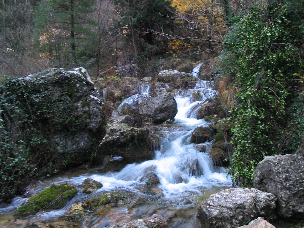
This Natural Area enjoys an impressive beauty, caused by the rains and snows that make the river flow from galleries and caves until it leaves the Cueva de los Chorros and falls as a more than 100 meters high waterfall.
We are talking about an easily accessible route with well-marked roads. However, you must take into account that due to the river humidity and water the road could be slippery.
This route of approximately 8 kilometers is worth doing to contemplate its waterfalls, its flora, its fauna and most impressive, the natural phenomenon of the blowout of the water through the cave.
If you are adventurous, and after contemplating where the Mundo River is born, you may want to enter the cave. You must bear in mind that it is a route of medium difficulty, and to visit the cave you must request a permit and be accompanied by a guide since access is restricted.
What do you think about our selection? Maybe your preferred route with water has not been mentioned, but you will agree with us that these are great excuses to go out and enjoy the summer.
So leave us a comment about your preferred route with water. Who knows? We may find ourselves in one of them this summer, enjoying the magnificent scenery and the peace brought by the water songs.
Apúntate a nuestra newsletter semanal
Te enviaremos un correo cada semana con el nuevo artículo junto a las novedades de nuestra app móvil de senderismo.

